-
Cesar Millan's Short Guide to a Happy Dog: 98 Essential Tips and Techniques
Cesar Millan
eBook (National Geographic, Jan. 2, 2013)After more than 9 seasons as TV’s Dog Whisperer, Cesar Millan has a new mission: to use his unique insights about dog psychology to create stronger, happier relationships between humans and their canine companions.Now in paperback, this inspirational and practical guide draws on thousands of training encounters around the world to present 98 essential lessons. Taken together, they will help dog owners create the most fulfilling life possible with their dogs.In these pages, Cesar delves into crucial themes that go beyond obedience-school basics to reveal the hearts and minds of our beloved pets. In short, practical takes, he explores:• The basics of dog psychology• Instinctual behaviors• Creating balance and boundaries• Managing common misbehaviors• Choosing the right dog for your family• Helping your dog adjust to life transitionsThroughout the book, inspiring stories from Cesar’s case files -- and from his TV show, Leader of the Pack – provide moving real-world applications and surprising life lessons.Smart, easy to use, and packed with Cesar's remarkable insights into human and canine behavior, A Short Guide to A Happy Dog is an inspiring tool for anyone looking to live a better life with a beloved member of the family.
-
Frances Mayes Always Italy
Frances Mayes, Ondine Cohane
Hardcover (National Geographic, March 31, 2020)The world's favorite expert on la dolce vita (Under the Tuscan Sun author) guides readers through Italy's iconic regions, replete with lavish National Geographic images.This lush guide, featuring more than 350 glorious photographs from National Geographic, showcases the best Italy has to offer from the perspective of two women who have spent their lives reveling in its unique joys. In these illuminating pages, Frances Mayes, the author of Under the Tuscan Sun and many other bestsellers, and New York Times travel writer Ondine Cohane reveal an Italy that only the locals know, filled with top destinations and unforgettable travel experiences in every region. From the colorful coastline of Cinque Terre and the quiet ports of the Aeolian Islands to the Renaissance architecture of Florence and the best pizza in Rome, every section features insider secrets and off-the-beaten-path recommendations (for example, a little restaurant in Piedmont known for its tajarin, a pasta that is the perfect bed for the region's celebrated truffles). Here are the best places to stay, eat, and tour, paired with the rich history of each city, hillside town, and unique terrain. Along the way, you'll make stops at the country's hidden gems--art galleries, local restaurants, little-known hiking trails, spas, and premier spots for R&R. Inspiring and utterly unique, this vivid treasury is a must-have for anyone who wants to experience the best of Italy.
-
National Geographic: Our Fifty States
Mark H. Bockenhauer, President Jimmy Carter
Hardcover (National Geographic, Aug. 16, 2005)National Geographic Our Fifty States- Overflowing with beautiful illustrations, specially designed maps, and concise essays written and reviewed by members of the Society's Geographic Alliance Program, this authoritative guide stands alone in the children's reference category. From Maine to Hawaii, kids will discover fascinating details behind each state's unique history. Our Fifty States is a superior volume so chock-full of engaging information and stunning visuals, youngsters will never run out of things to learn. Over 300 full-color photographs and archival illustrations. Specially designed maps of each state, region, the District of Columbia, U.S. Territories, and the country as a whole. Lively, fun-to-read state and regional essays written by two professors of geography. Fact boxes with key statistics for each state. Flags, birds, and flowers for each 50 states. Photo essays on the District of Columbia and the U.S. Territories. Facts and figures for comparing and contrasting key economic activities and geographic features. Perfect for school reports or armchair travel across the U.S.A.
-
Appalachian Trail, Damascus to Bailey Gap
National Geographic Maps - Trails Illustrated
Map (National Geographic Maps, Oct. 23, 2015)• Waterproof • Tear-Resistant • Topographic MapThe Damascus to Bailey Gap Topographic Map Guide makes a perfect traveling companion when traversing the southwest Virginia section of the Appalachian Trail (A.T.). The A.T. in southwest Virginia travels through a culturally and historically rich area that includes fertile farmland, long, wooded ridges, and the highest mountains in the state. While the Mt. Rogers high country, just east of Damascus, is very popular with visitors, hikers can find excellent opportunities for solitude farther north on their way to the New River and Bailey Gap.Each A.T. Topographic Map Guide includes detailed topographic maps at a detail of 1 inch = 1 mile. Each page is centered on the A.T. and overlaps with the adjacent pages so there is little chance of getting lost. Along the bottom of each page is a trail profile that shows the distance between shelters, camping areas, and trail access points. The map and trail profile provide a step by step visual guide to hiking the trail, mile by rugged mile. The Topographic Map Guide is built for all levels of hiking enthusiasts, from the day tripper to the multi month 'thru-hiker'. The front pages of the printed Topographic Map Guide include resupply information, town inset maps, camping options, and much more.Every Topographic Map Guide is printed on "Backcountry Tough" waterproof, tear-resistant paper. A full UTM grid is printed on the map to aid with GPS navigation.Other features found on this map include: Abingdon Gap Shelter, Atkins, Bailey Gap Shelter, Bastian, Bland, Bluefield, Chatfield Shelter, Chestnut Knob Shelter, Damascus, Doc's Knob Shelter, Grayson Highlands State Park, Helveys Mill Shelter, Hurricane Mtn Shelter, Jefferson National Forest, Jenkins Shelter, Jenny Knob Shelter, Knot Maul Branch Shelter, Lost Mtn Shelter, Marion, Mount Rogers, Old Orchard Shelter, Partnership Shelter, Pearisburg, Pine Swamp Branch Shelter, Princeton, Rice Field Shelter, Saunders Shelter, Tazewell, Thomas Knob Shelter, Trimpi Shelter, Wapiti Shelter, Wise Shelter.Map Scale = 1:63,360Folded Size = 4.25" x 9.25"
-
Saguaro National Park
National Geographic Maps - Trails Illustrated
Map (National Geographic Maps, July 11, 2014)• Waterproof • Tear-Resistant • Topographic MapNational Geographic's Trails Illustrated map of Saguaro National Park and surrounding areas to the east and west of Tucson, is the perfect map for hiking, biking, exploring, climbing, riding, camping, and sightseeing in this beautiful desert wilderness. Created in partnership with local land management agencies, this expertly researched map highlights key areas of interest including Tucson Mountain Park, Sweetwater Preserve, Robles Pass, Saguaro Wilderness, Tanque Verde Ridge, and Hope Camp, Yetman, and Petroglyphs trails. This map features detailed topography with shaded relief, elevations, and clearly defined, color-coded boundaries for parks, public lands, and wilderness areas. With miles of mapped trails including a portion of the Arizona Trail, this map can guide you off the beaten path and back again in some of the most iconic scenery in the desert southwest. The clearly marked trails include mileage between intersections and handy hiking and trailhead summaries will help you choose the path that's right for you. Recreation features are clearly marked, including campgrounds, interpretive trails, rifle and archery ranges, scenic drives, picnic areas, and points of interest.Every Trails Illustrated map is printed on "Backcountry Tough" waterproof, tear-resistant paper. A full UTM grid is printed on the map to aid with GPS navigation.Other features found on this map include: Coronado National Forest, Rincon Mountain Wilderness, Rincon Mountains, Saguaro National Park, Spud Rock, Tucson Mountains.Map Scale = 1:35,000Sheet Size = 25.5" x 37.75"Folded Size = 4.25" x 9.25"
-
Mount St. Helens, Mount Adams
National Geographic Maps - Trails Illustrated
Map (National Geographic Maps, Jan. 1, 2010)• Waterproof • Tear-Resistant • Topographic MapMount St. Helens is an active volcano in Washington's Cascade Range. Neighboring peak Mount Adams is the second highest summit in Washington after Mount Ranier. Explore the beauty and geological wonder of these magnificent mountains with National Geographic's Trails Illustrated map of Mount St. Helens, Mount Adams. Created in partnership with local land management agencies, this expertly researched map features key areas of interest including Mount St. Helens National Volcanic Monument; Trapper Creek Wilderness; Swift Reservoir; Salmon, Cispus, and Lewis rivers; and Yale, Coldwater, and Spirit lakes.This map can guide you off the beaten path and back again with miles of mapped trails including a portion of the Pacific Crest National Scenic Trail. Helpful information on Mount Margaret, Indian Heaven Wilderness, climbing Mount St. Helens, mountain safety tips and more will prove invaluable in your exploration of the region. Many recreation features are noted as well, including interpretive trails, campgrounds, ATV trails, sno-parks, cross country ski trails, and horse camps.Every Trails Illustrated map is printed on "Backcountry Tough" waterproof, tear-resistant paper. A full UTM grid is printed on the map to aid with GPS navigation.Other features found on this map include: Bare Mountain, Gifford Pinchot National Forest, Goat Rocks Wilderness, Indian Heaven Wilderness, Little Huckleberry Mountain, McCoy Peak, Mount Adams, Mount Adams Wilderness, Mount Saint Helens, Spirit Lake, Swift Reservoir, Trout Lake, Yale Lake.Map Scale = 1:75,000Sheet Size = 25.5" x 37.75"Folded Size = 4.25" x 9.25"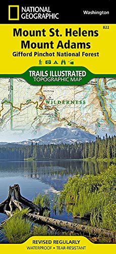
-
The Essential Lewis and Clark
Meriwether Lewis, William Clark, Anthony Brandt
eBook (National Geographic, Feb. 6, 2018)With nuanced observations from the star author and historian, here are the celebrated journals documenting Lewis and Clark's legendary expedition into the uncharted American West, abridged into a single volume and translated into modern English.At the start of the 19th century, Meriwether Lewis and William Clark embarked on an unprecedented voyage of discovery. Their assignment was to explore the newly acquired Louisiana Territory and record the geography, flora, fauna, and people they encountered along the way. This updated edition of the captains' journals combines historical insight from editor Anthony Brandt with the rich detail of Lewis and Clark's original writing, as well as archival maps and artwork. An enthralling portrait of the unspoiled West, this true-life adventure story is a window to the dawning of America--from encounters with grizzly bears to councils with tribal leaders and perilous mountain crossings.
-
Who's Who in American History: Leaders, Visionaries, and Icons Who Shaped Our Nation
K. M. Kostyal, John M. Thompson, William R. Gray
Hardcover (National Geographic, Oct. 24, 2017)This beautiful family reference from National Geographic tells the story of America through its presidents, revolutionaries, visionaries, inventors, entertainers—and even its most notorious villains.Far more than an encyclopedia, this treasury tells the rich stories of the people who made America's history—and adds context with lush photographs, illustrations, timelines, artifacts, and more. Beginning with pre-colonial America and continuing through today, this beautifully illustrated book details the fascinating lives of the men and women who helped build the story of our nation. Arranged chronologically, it features more than 400 entries illustrated with lavish four-color photography and elegant illustrations. Intriguing stories and historical maps provide additional context in this comprehensive and enlightening look at America's storied past.
-
Everest : Mountain Without Mercy
Broughton Coburn, Tim Cahill
Hardcover (National Geographic, Oct. 1, 1997)More than 125 full-color photographs, including spectacular IMAX images, and firsthand accounts by survivors chronicle the fateful 1996 expedition to climb Everest, a trek that ended up claiming eight lives. 100,000 first printing. BOMC. First serial, National Geographic. Tour.
-
National Geographic: World Classic Wall Map - Laminated
National Geographic Maps - Reference
Map (National Geographic Maps, Dec. 28, 2016)National Geographic's World map is the standard by which all other reference maps are measured. The World map is meticulously researched and adheres to National Geographic's convention of making independent, apolitical decisions based on extensive research using multiple authoritative source.The signature Classic style map uses a bright, easy to read color palette featuring blue oceans and stunning shaded relief that has been featured on National Geographic wall maps for over 75 years. Drawn in the Winkel Tripel projection, distortions are minimized and unlike many other World maps, Greenland is show the same size as Argentina and not as the size of all of South America.Thousands of place names are carefully and artistically placed on the map to maintain legibility even in the heavily populated areas of Europe, Asia and the Middle East. Details include clearly defined international boundaries, cities, physical features, rivers, and ocean floor features. Corner inset maps feature vegetation and land use, and population density as well as the north and south polar regions.The map is encapsulated in heavy-duty 1.6 mil laminate which makes the paper much more durable and resistant to the swelling and shrinking caused by changes in humidity. Laminated maps can be framed without the need for glass, so the fames can be much lighter and less expensive. Map Scale = 1:31,900,000Sheet Size = 43.5" x 30.5"
-
National Geographic Little Kids: First Big Book of Dinosaurs by Catherine D. Hughes
None
Paperback (National Geographic Society, )None
-
National Geographic Atlas of the Ocean: The Deep Frontier
Sylvia Earle
Hardcover (National Geographic, Oct. 1, 2001)Internationally renowned deep-sea pioneer and National Geographic Explorer-in-Residence Sylvia A. Earle, in consultation with experts from NASA and the National Oceanic and Atmospheric Administration, is our peerless guide. This one-of-a-kind atlas immerses us in the infinite wonders of the world offshore through more than 150 cutting-edge maps, photographs, and satellite images. Atlas of the Ocean lays bare a realm as challenging and untapped as spaceand as vital to our existence as the air we breathe. Accompanying exquisite, up-to-the-minute maps, Earles compelling text reveals the beauty and complexity of the ocean structurepast, present, and futureand explores its flora, fauna, and diverse phenomena, from giant squid and kelp to the smallest microbial bodies. Fascinating point maps take us into the planets deepest abyss, the Mariana Trench; along the planets longest mountain chain, the Mid-Atlantic Ridge; on the migration route of humpback whales; and to a host of marine sanctuaries worldwide. An unequaled resource for both education and entertainment, Atlas of the Ocean also explores the progress of fascinating technological developments that will help scientists discover the oceans innumerable uncharted regions and life-forms.